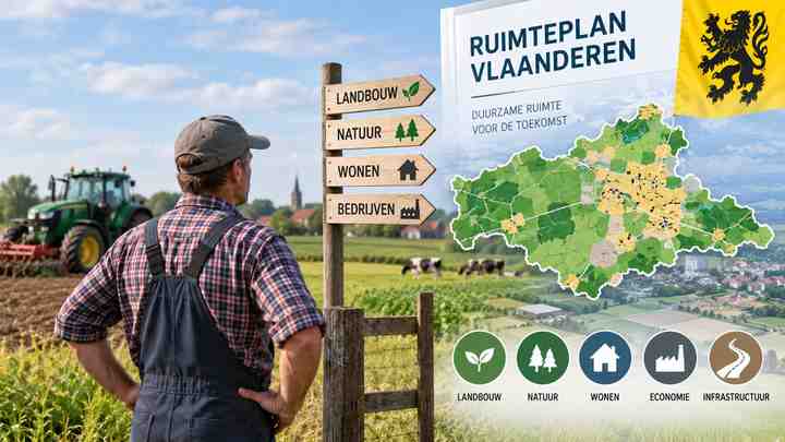
The Nieuw Ruimteplan Vlaanderen: Wat Betekent Dit voor Vlaamse Landbouwers? (ruimteplan landbouw Vlaanderen) question matters because the proposed Flemish spatial plan could shape where farming can continue, where land may be protected, and how future land-use decisions are made.
For farmers, the key message is cautiously positive: the draft Beleidsplan Ruimte Vlaanderen (BRV) recognises agriculture as a strategic sector and proposes to retain 765,000 hectares of agriculturally designated land. However, a designation on a planning map is not automatically the same as land that is available, affordable, or practically usable for a professional farm.
For Indian readers following European agriculture, food supply chains, agri-investment, or Belgian farming policy, this is a useful example of how a densely populated region is trying to balance food production, housing, industry, water management, biodiversity, and climate resilience.
What is the new Flemish spatial plan?

The Beleidsplan Ruimte Vlaanderen, commonly called the BRV, is intended to replace the older Ruimtelijk Structuurplan Vlaanderen. It sets long-term direction for spatial policy in Flanders, the Dutch-speaking region of Belgium.
It is important to understand what the BRV does and does not do.
The BRV is a policy framework, not a plot-by-plot zoning rulebook. It provides the direction for future planning decisions, regulations, land-use instruments, and more detailed spatial plans. Existing zoning plans and local or regional planning instruments remain important when a farmer applies for a permit, develops a site, or faces a land-use change.
The current draft includes a dedicated policy framework for land and horticulture, often described as “Ruimte voor land- en tuinbouw” or space for agriculture and horticulture. Its central idea is that professional farming needs a durable place in Flanders’ open countryside.
The headline number: 765,000 hectares of agricultural designation
The most discussed commitment is the aim to maintain 765,000 hectares of land with an agricultural planning designation.
This figure should be read carefully. It refers to land designated for agriculture in spatial planning, not necessarily to 765,000 hectares that are all actively farmed today. Agricultural zones can include homes, roads, watercourses, woodland fragments, and other non-farming uses. Conversely, some actively farmed land may sit outside an agricultural zoning category.
The draft plan also envisages converting 30,000 hectares of unbuilt “hard” destinations—land assigned to uses such as housing or industry but not yet developed—into open space. Half of that area, or 15,000 hectares, is intended for agriculture, while the other half is intended for nature and forest.
| What the plan proposes | Why it matters to farmers |
|---|---|
| Retain 765,000 hectares of agricultural designation | Gives agriculture a clearer long-term place in spatial policy |
| Convert 15,000 hectares of unbuilt hard-designated land to agriculture | Could strengthen the agricultural land base over time |
| Convert 15,000 hectares to nature and forest | Supports wider open-space goals but may create local land-use trade-offs |
| Reduce additional land take towards zero by 2040 | Limits outward development pressure on open land |
| Align land use and planning designation more closely | May help identify land that should be available to active farmers |
For an individual farm, this does not mean an immediate allocation of land. The practical result will depend on later regulations, implementation programmes, local plans, ownership, leases, permits, and funding.
Why Flemish farmers need this protection
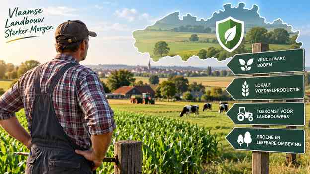
Flanders is one of Europe’s most intensively used regions. Agriculture competes for space with homes, logistics, roads, industry, recreation, renewable energy, flood management, and ecological restoration.
Official agricultural statistics show that farming remains a major land user in the region. Yet agricultural land has declined over the longer term, while the land that remains is often fragmented or faces pressure from non-agricultural uses.
For a farm business, losing even a few parcels can affect more than acreage. It may disrupt manure planning, crop rotation, grazing access, machinery logistics, financing, or eligibility for support measures. Fragmented land can also increase travel time and operating costs.
The new ruimteplan landbouw Vlaanderen therefore aims to do more than preserve open scenery. Its underlying purpose is to secure sufficient land for food and raw-material production, while improving the quality and resilience of the rural landscape.
What could improve for active farmers?
A stronger recognition of farming as a strategic activity
The draft plan explicitly treats land and horticulture as strategically important to Flanders. This is significant because spatial decisions have often been framed around development, conservation, or infrastructure, with agriculture treated as a residual use.
A stronger policy position may help ensure that farming is considered earlier when authorities assess land conversions, open-space projects, or regional development plans.
More focus on professional agricultural use
One policy aim is to increase the share of agricultural land used professionally. This responds to a persistent issue: land zoned for farming is not always available to active farmers. It may be used for hobby activities, non-agricultural storage, residential gardens, horse keeping, or other functions that restrict access for commercial agriculture.
For young farmers and expanding businesses, improved access to suitable parcels could be more meaningful than an impressive headline land-area target.
Better alignment between maps and reality
The plan seeks closer alignment between actual land use and formal planning designation. That process could clarify where farming should remain the primary activity and where different uses are more appropriate.
However, such alignment can be politically and practically difficult. A farm should not assume that a policy objective will automatically change the status of a specific parcel. Changes generally need formal planning procedures and may involve public consultation.
Potential support for climate-resilient farming landscapes
The BRV links agriculture with water, biodiversity, soil, and climate objectives. In practice, this could support projects involving water retention, soil protection, landscape elements, agroforestry, erosion control, or carefully designed nature-management agreements.
These measures can create opportunities, but farmers should evaluate them commercially. A project that improves water availability or soil health may be valuable; one that adds long-term management obligations without fair compensation may not suit every business model.
What does not change overnight?
The new spatial plan is not an instant law that changes every farm’s rights or obligations. At the current draft stage, it still needs to proceed through the formal planning process before becoming a definitive regional policy plan.
It also does not replace existing rules on:
- Building and environmental permits
- Zoning and regional implementation plans
- Nature and water requirements
- Nitrate and manure rules
- Common Agricultural Policy support conditions
- Lease agreements and property rights
A farmer’s existing parcel situation remains governed by the applicable legal instruments, not by a general policy statement alone. This distinction is essential when reading headlines about “more agricultural land.”
The biggest concern: designated land is not always farmable land

The central debate is not only about how much agricultural land is marked on planning maps. It is about whether active farmers can actually use it.
A large agricultural designation can coexist with limited access to workable fields if parcels are occupied by non-farm uses, split among owners, too small for modern operations, subject to short leases, or constrained by local environmental conditions.
That is why agricultural organisations have called for concrete measures to:
- Keep agriculturally zoned land primarily available for agriculture
- Reduce inappropriate non-agricultural use in farm zones
- Improve access to land for young and future farmers
- Protect viable farm sites when agricultural buildings become vacant
- Create fair mechanisms for environmental and ecosystem-service obligations
- Give farmers certainty before land-use restrictions affect their operations
The BRV’s value will ultimately be judged by its implementation, not only by the 765,000-hectare target.
What could the plan mean for farm expansion and permits?
For farm expansion, the effect is likely to be indirect but important.
A planning framework that prioritises compact development and reduced land take may make it harder for non-agricultural development to spread into open areas. That could reduce some long-term pressure on farmland.
At the same time, farms themselves may face greater scrutiny when proposing new buildings, hard surfaces, access roads, or site expansions. Authorities will still examine location, landscape impact, water management, mobility, environmental requirements, and local planning rules.
A sound application will need to show why the project is necessary for a viable agricultural business and how it fits the site. In many cases, using existing buildings efficiently, limiting impermeable surfaces, managing rainwater well, and avoiding poorly located expansion will strengthen a proposal.
Water, nature and farming: opportunity and obligation
The new plan sees open space as multifunctional. Agriculture is expected to produce food, but rural land is also expected to hold water, support biodiversity, store carbon, and provide landscape quality.
That can create tension. A farmer may welcome better drought resilience or payment for a management service, yet worry about reduced flexibility, extra paperwork, or permanent restrictions.
The practical question should be: who carries the cost and risk?
Before joining a water, biodiversity, temporary-nature, or landscape project, farmers should check:
- The duration of the agreement
- Whether participation limits future cultivation or construction
- The payment level and payment security
- Who is responsible for maintenance and compliance
- How the commitment interacts with lease rights, permits, and agricultural support
- Whether the project can be ended or adapted if the farm changes
Temporary nature and landscape measures can be useful only when they do not unexpectedly undermine future farm operations.
A practical checklist for Flemish farmers
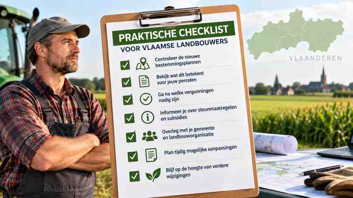
Farmers do not need to wait passively for the final BRV. Preparing early is sensible.
Review your land position
Create an up-to-date overview of owned and leased parcels, agricultural designations, actual use, access routes, water features, and existing restrictions. The Flemish agricultural geolocation tools and local planning information can help identify issues before they become urgent.
Check vulnerable parcels
Pay special attention to plots near expanding towns, industrial areas, flood-prone zones, nature projects, transport corridors, or recreation areas. These locations may face the most complex future planning choices.
Keep evidence of active agricultural use
Accurate parcel declarations, lease documentation, farm records, and maps are valuable. They support discussions about professional agricultural use and can be important during consultations or permit procedures.
Engage with consultations
When draft plans, regional implementation plans, or local projects go to public consultation, affected farmers should participate. Land-use decisions are easier to influence before they are finalised.
Ask for parcel-specific advice
A general policy target cannot answer a parcel-specific legal question. For a planned investment, acquisition, expansion, or dispute, obtain advice from a recognised agricultural adviser, planning specialist, municipality, or relevant Flemish authority.
What this means for Indian readers and agribusiness observers
The Flemish plan is not relevant to Indian consumer-tech pricing or retail availability; it is a regional land-use policy. Its wider significance for Indian readers lies in agricultural and supply-chain context.
Flanders is closely connected to European food processing, horticulture, dairy, livestock, logistics, and agricultural technology. Land availability and environmental planning can influence farm investment, production patterns, and long-term sourcing decisions. Indian businesses working with Belgian food, farm-equipment, sustainability, or agri-tech partners should recognise that land access is becoming a central business issue, not merely an environmental one.
Final view
The Nieuw Ruimteplan Vlaanderen: Wat Betekent Dit voor Vlaamse Landbouwers? (ruimteplan landbouw Vlaanderen) can be summed up simply: it gives agriculture a stronger place in Flanders’ long-term spatial strategy, but its real benefit will depend on detailed implementation.
The proposed 765,000-hectare agricultural designation, the proposed return of some unbuilt hard-designated land to open space, and the focus on professional agricultural use are encouraging signals. Yet farmers need workable, accessible land, predictable permits, fair compensation for public services, and confidence that temporary environmental measures will not compromise their future.
The plan is therefore a promising framework—not a finished guarantee.
FAQs
Is the new Beleidsplan Ruimte Vlaanderen already final?
No. The plan has moved into the draft stage and must still complete the formal process before it becomes a definitive policy plan. Existing legal rules and planning instruments continue to apply.
Does 765,000 hectares mean all that land is currently being farmed?
No. The figure refers to land with an agricultural planning designation. Actual agricultural use can be lower because designated zones may also contain homes, roads, water, woodland, and other uses.
Will farmers automatically receive more land under the new plan?
No. The plan does not automatically transfer land to farms or change ownership. Access will depend on implementation measures, local planning, leases, land markets, and land-use decisions.
Can a farmer build new sheds or expand a farm more easily because of the BRV?
Not automatically. Building and expansion proposals still require assessment under the applicable zoning, permit, environmental, water, and local planning rules.
Why is professional agricultural use a major issue?
Land designated for agriculture is not always available to commercial farms. Strengthening professional use could help active and young farmers access land that is currently underused or occupied by non-agricultural activities.
What should a farmer do now?
Review parcel maps and leases, monitor local planning consultations, document active agricultural use, and seek parcel-specific advice before making major land or building decisions.